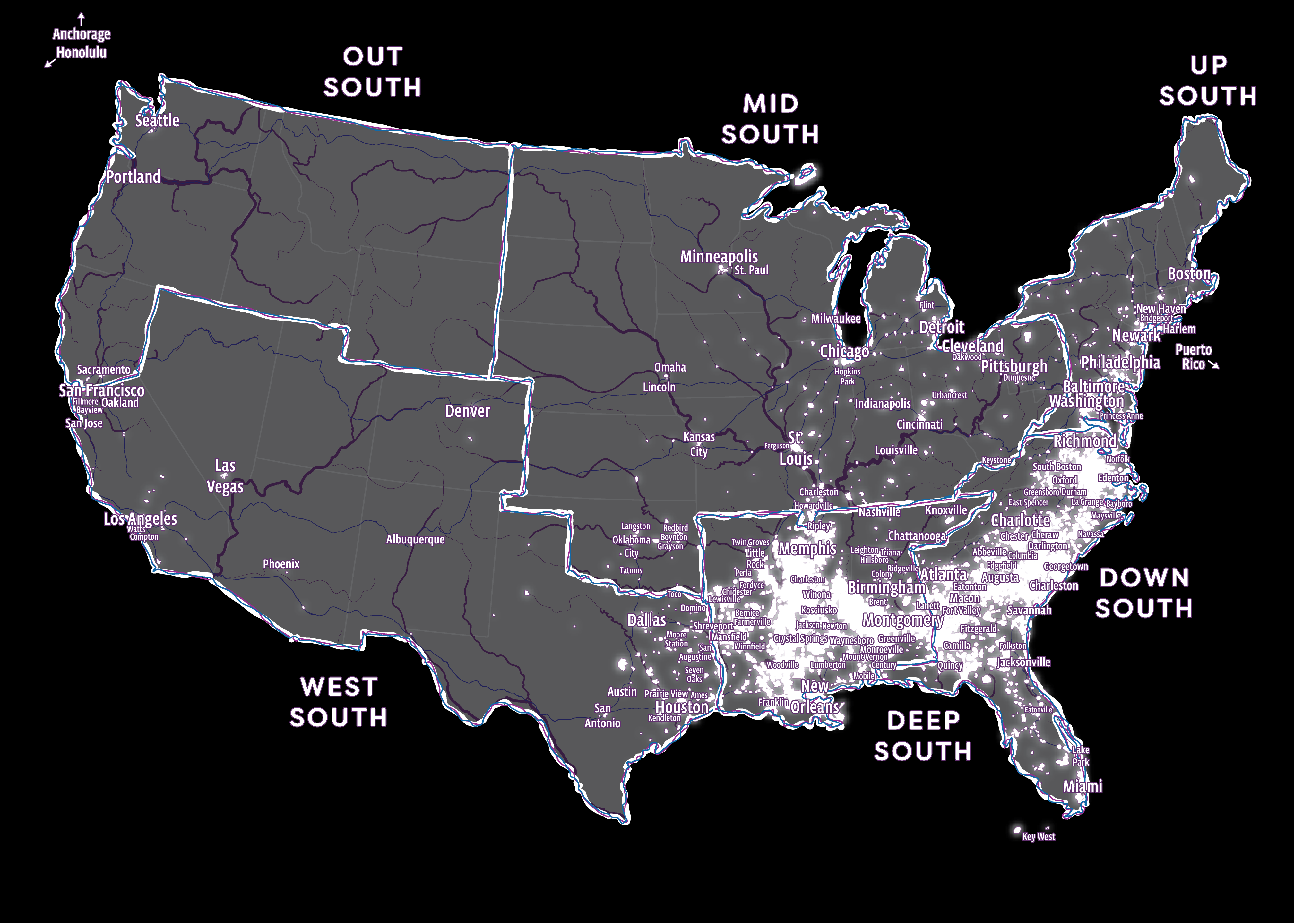
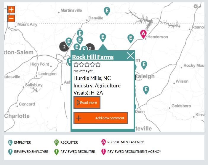
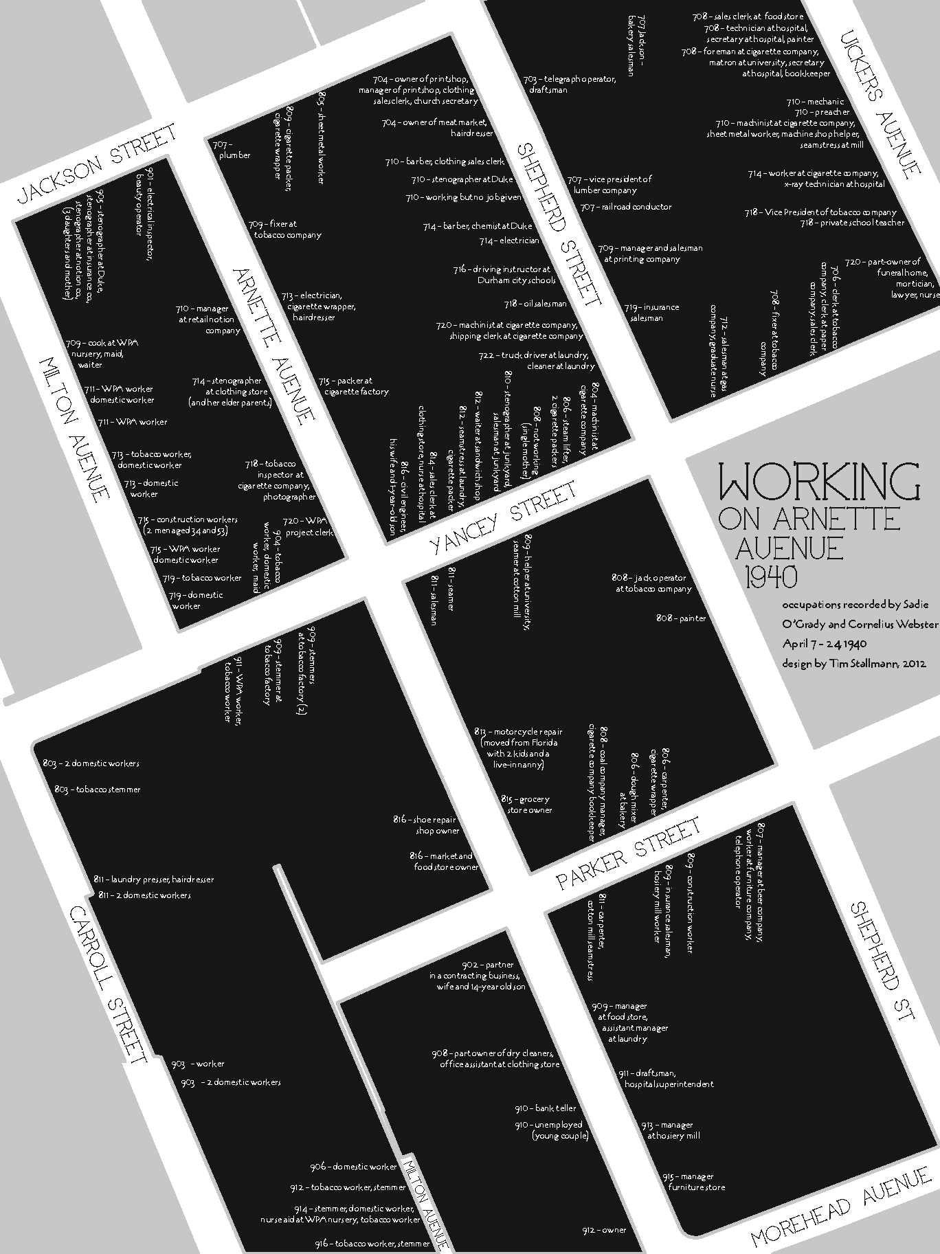
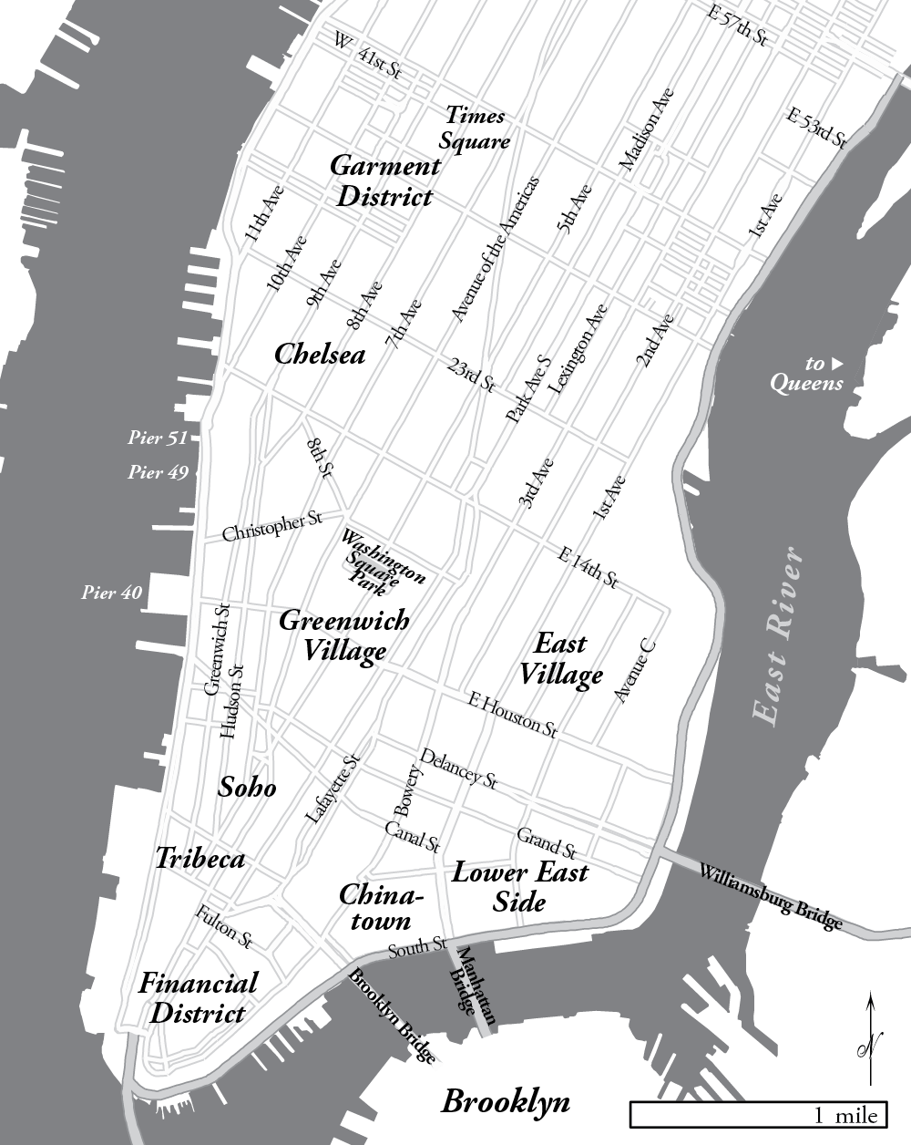
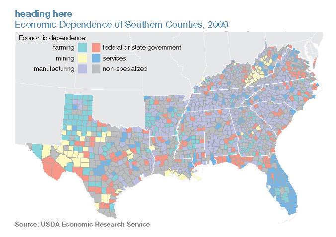
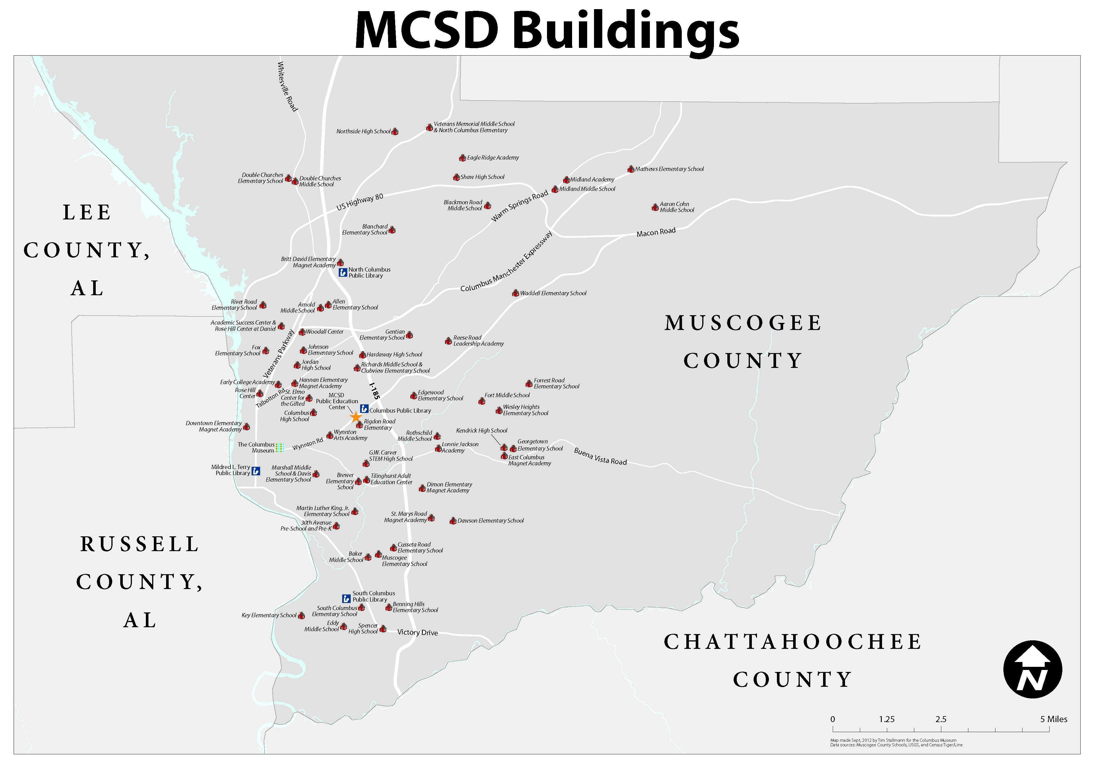
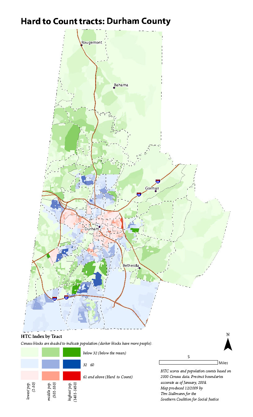
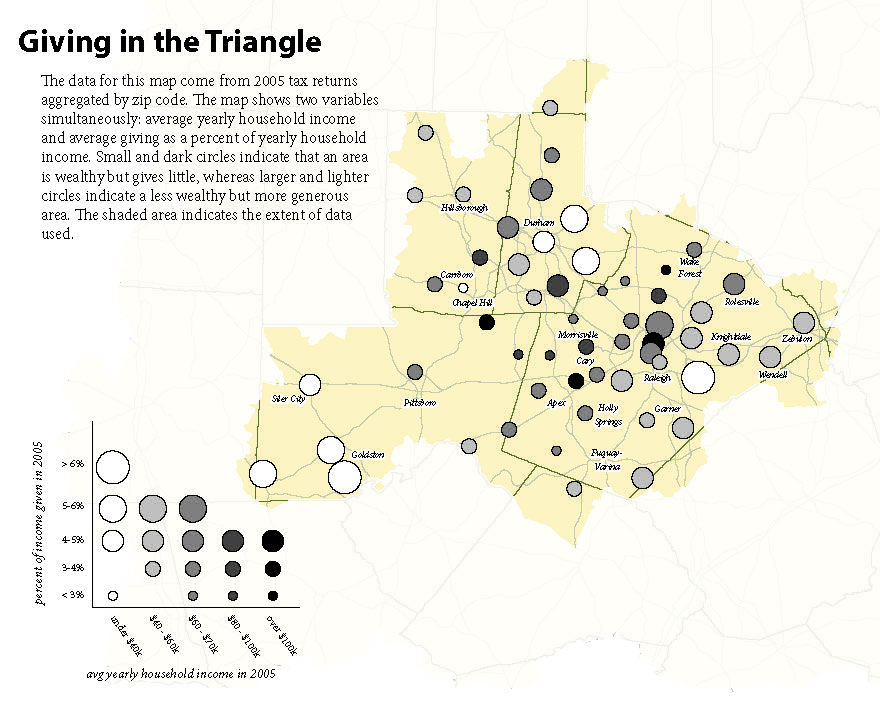
Contratados.org (2014-present) Who works on Arnette Avenue? (2012) I made this map using the then-newly released PDFs of... NYC Map for “Safe Space” (2012) This map is one of several produced for State of the South (2011) This is one of several maps I produced for MDC's 2011... School map for the Columbus Museum (2012) I produced this wall map of local schools for the... Census 2010 Outreach Maps (2009) In preparation for the 2010 Decennial Census, the... Giving in the Triangle (2007) The Program on Public Life at UNC-CH commissioned a... Posts navigation Older posts Top
NYC Map for “Safe Space” (2012) This map is one of several produced for State of the South (2011) This is one of several maps I produced for MDC's 2011... School map for the Columbus Museum (2012) I produced this wall map of local schools for the... Census 2010 Outreach Maps (2009) In preparation for the 2010 Decennial Census, the... Giving in the Triangle (2007) The Program on Public Life at UNC-CH commissioned a... Posts navigation Older posts